


MapPad GPS Land Surveys

MapPad GPS Land Surveys의 설명
맵 패드를 사용하여 면적, 둘레 및 거리를 계산하고 측정 값을 저장, 내보내기 또는 공유하십시오.
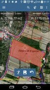
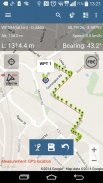
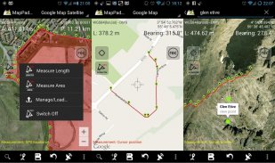
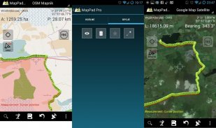
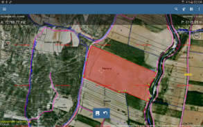
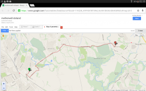
MapPad는 위치 캡처가 가능하고지도에 그려 지거나 실시간 GPS 추적을 사용하여 캡처 한 도형의 거리와 면적을 결정하는 다목적 매핑 솔루션을 제공합니다.
Google 또는 Bing Map Satellite보기를 사용하여 필드 영역이나 도보 거리를 즉시 계산하십시오. 몇 번의 클릭만으로 휘발유 및 시간을 절약하고 기능을 캡처하십시오.
MapPad를 사용하면 데이터를 쉽게 캡처, 관리 및 공유 할 수 있습니다.
MapPad는 임업, 농업, 엔지니어링 및 부동산 관리에 관련된 모든 사람에게 매우 유용한 도구입니다.
오프라인지도를 준비하고이 제품에 대한 자세한 정보를 얻으려면 웹 사이트를 방문하십시오.
선택된 기능 :
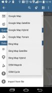
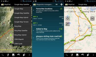
-기본지도 : Google Maps, Open Street Map, Bing Maps
-Google지도 오버레이 (사용자 정의 WMS 또는 ArcGIS 서버 타일 서비스), 미국 지형도와 같은 일부 레이어가 사전 정의되었습니다.
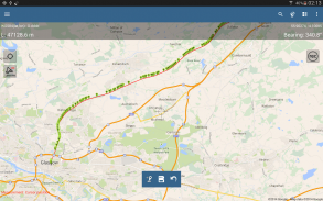
-면적과 거리를 매우 정확하게 측정합니다.
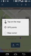
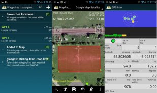
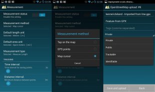
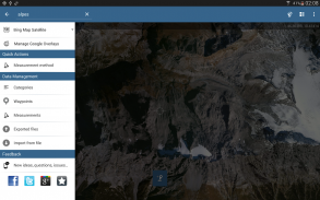
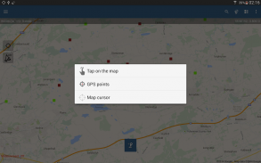
-3 가지 측정 방법이 지원됩니다 (지도에서 누르기, GPS 위치,지도 커서 위치).
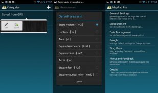
-다수의 미터법 및 영국식 단위 지원.
-여러 글로벌 및 로컬 좌표 시스템에 대한 지원, 다른 공간 참조에 대한 지원이 필요한 경우 연락하십시오.
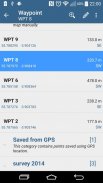
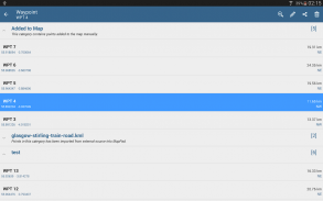
-웨이 포인트를 캡처하여 범주별로 그룹화 할 수 있습니다.
-기록 된 각 측정 및 웨이 포인트에 대한 제목 및 설명을 추가하거나 편집 할 수 있습니다.
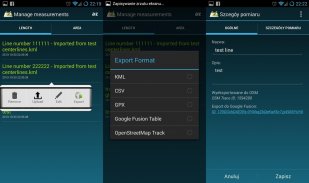
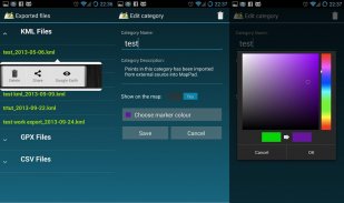
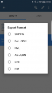
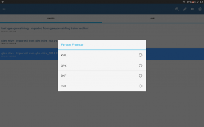
-단일 또는 다중 측정 또는 웨이 포인트를 SHP 파일, Geojson, ArcGIS Json, KML, GPX, CSV 및 DXF로 SD 카드 또는 클라우드 서비스로 내보내고 Open Street Map으로 직접 내 보냅니다.
-단일 웨이 포인트 위치를 SMS, 이메일 또는 다른 방법으로 직접 공유하십시오.
-GPS로 수행 한 측정에 사용할 수있는 고도 프로파일.
-KML 및 GPX 파일을 응용 프로그램으로 가져옵니다.
-GPS 상태 및 위성 상태.
-주소, 위치 검색.
-Google 어스에서 내 보낸 KML 파일을 빠르게 엽니 다.
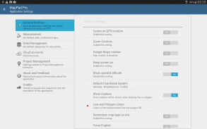
-기본 측정 단위, 웨이 포인트의 카테고리 색상, 기록 시간 및 거리 간격 추적, Google지도 오버레이의 투명도 등을 설정하는 기능 ...
우리의 사용자는 많은 프로젝트와 응용 프로그램에서 MapPad를 성공적으로 사용하고 있습니다.
MapPad GPS Land Surveys - 버전 7.5.0
(19-05-2019)
MapPad GPS Land Surveys - APK 정보
APK 버전: 7.5.0패키지: com.osedok.mappadMapPad GPS Land Surveys의 최신 버전
다른 버전들


동일 카테고리의 앱

좋아할 만한 것...


